Hurricane Sensor Research May Lead to Stronger Buildings
As the world has seen in the Bahamas with Hurricane Dorian, the destructive power of these powerful storms is unquestionable. Florida Tech is taking part in research to better understand the damage that can be done by violent winds and how to better defend against it.
Florida Tech is one of 11 organizations that have received grants totaling $6.6 million from the U.S. Department of Commerce’s National Institute of Standards and Technology (NIST). Mechanical and civil engineering professor Jean-Paul Pinelli, aerospace engineering professor Chelakara Subramanian and ocean engineering and marine sciences professor Steven Lazarus are the primary investigators for the project.
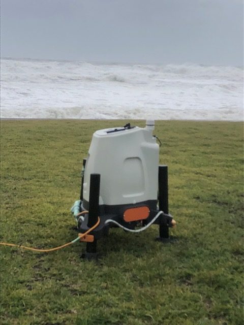
Florida Tech’s $421,000, three-year grant will go towards a project to develop a unique wireless sensor network system and wind-detecting LiDAR (the remote sensing method Light Detection and Ranging) measurements to characterize wind profiles near the ground and subsequent wind loads on non-structural components of buildings such as architectural details or electrical systems.
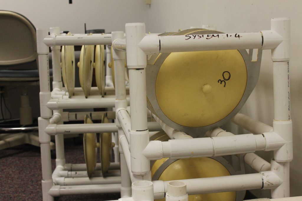
The new network will replace an older network, developed 10 years ago, which is composed of three systems. Each system consists of an anemometer and 30 weatherproof pressure/temperature sensors which are deployed on various points of a structure’s roof. The sensors communicate to a base unit either directly or via routers, and the unit stores time series data including pressure, temperature, wind speed and wind direction.
The older sensors were deployed for Hurricane Dorian, and the new system will be operational for the 2020 hurricane season.
With the help of Jiten Chandiramani, CEO and founder of Jaycon Systems and a former Florida Tech student under Subramanian, the team developed the initial wireless sensor network to measure pressure variations around buildings to quantify wind loads on full-scale residential building roofs and envelope components such as soffits and windows.
Each Florida Tech researcher brings a different skill set and expertise to the NIST-funded project. Subramanian’s experience with experimental fluid dynamics and wireless instrumentation is key in the development of the one-of-a-kind sensors. While researching the wind’s effects on structures can also be performed using hurricane simulators, the goal here is to collect real-world data on the storms.
“If we have a certain wind speed and wind direction, and if we have a sensor in the wake of that flow, then what kind of pressures occur?” Subramanian said. “Is it a positive or negative pressure perturbation, does it cause lifting, and is the structure affected by vibration and possible fatigue effects?”
For Pinelli, his knowledge of wind and structural engineering is key to analyzing the sensor data and understanding how buildings are affected by the wind. Pinelli hopes that a better understanding of the pressure fluctuation and its effect on structures will provide critical information that can be used to better assess current building codes and standards – and quite possibly improve them.
“The building codes seem to underestimate these pressures, so we want to verify if that’s the case and if it is so, what will be a better estimate of these pressures, so that we can design stronger components that will not fail during a hurricane,” Pinelli said.

Pinelli’s work will intersect with Lazarus’ LiDAR research to give the team a better understanding of the near surface winds during high-impact events. Lazarus has had a 3-foot-tall mobile LiDAR drum since 2014 and measures wind profiles as high as approximately 1,000 feet.
The LiDAR research is essential to developing a better understanding of how the wind interacts with the built environment. While the sensors on the house analyze the gusts’ impact on buildings, Lazarus’ research is recording and analyzing the wind coming off water – in other words, unimpeded by buildings or trees. Data that were recently collected in Satellite Beach during Hurricane Dorian showed a 55-mile per hour gust at approximately 32 feet, with 65-mile per hour gust at 82 feet associated with a squall.
Even with relatively “clean” (i.e. unobstructed) wind observations, terrain can cause wind turbulence.
“What happens is you get disruption over the barrier island as the east-to-west flow goes from the open ocean to the barrier island, then the wind recovers near the surface as it crosses over the (Indian River Lagoon) water again. Thus, you can end up with a wind profile that reflects the old one (barrier island) above, and a new one (smooth) underneath it,” Lazarus said.
The past few decades have seen a tremendous increase in coastal population and most states are increasingly vulnerable to hurricane impacts as a result. Using an integrated approach across multiple disciplines, Florida Tech researchers are working to better understand wind-building interaction and toward a better characterization of the near-surface wind profile and turbulence.
###